Atlases Charts and Maps
Showing all 14 results
-
Sale!
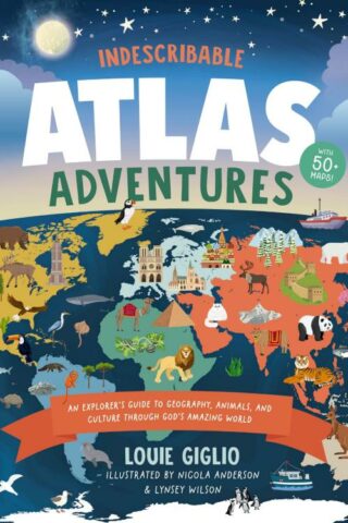
Indescribable Atlas Adventures
Original price was: $28.99.$17.97Current price is: $17.97.Add to cartWith more than 50 infographic maps, this illustrated world atlas for kids from bestselling author Louie Giglio will stretch your children’s understanding of the world as they discover more about God, science, and His amazing world!
Indescribable Atlas Adventures offers a self-guided tour for your favorite explorer throughout the seven continents and over 50 countries. Easy-to-read maps, more than 1,500 facts, and a world map that helps kids identify each continent and country will help your child to think globally and discover new insights into God’s incredible creation. Each map includes:
*an overview of each country’s population, languages, and prominent features;
*key facts about the country’s capital cities; neighboring countries; and the national bird, tree, and dish;
*notable people and their amazing achievements;
*the country’s terrain, climate, wildlife, contributions to space exploration, cultural hallmarks, and Christian faith traditions; and
*biblical and inspirational pieces, like devotional thoughts, prayers, and Bible verses that highlight how amazing God and His world are.
Indescribable Atlas Adventures is for ages 6 to 10 and spotlights several fascinating ecosystems, like the Sahara, Amazon, and Great Barrier Reef. This book has a large trim size to help kids explore fun details on each page and is a perfect “my first atlas of the world” gift for curious kids.
-
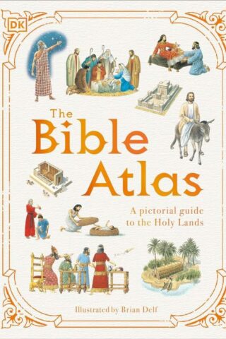
Bible Atlas : A Pictorial Guide To The Holy Lands
$20.00Add to cartDiscover where events in the Old and New Testaments took place and see how people lived in Biblical times in this illustrated guide.
Take a trip around the Holy Land with this collection of beautifully drawn maps, which show where events from the Bible took place.
Introducing The Bible Atlas – a beautifully illustrated guide to the geography, events and people of the Old and New Testaments for children aged 9-12. In illustrated guide, follow the journeys of the patriarchs, view inside Solomon’s Temple, witness Jesus’ miracles, and see exactly where Paul traveled while spreading the message of Christianity.
Dive straight into this pictorial Bible guide for kids, offering:
– An illustrated guide to key events of the Old and New Testaments for children.
– A variety of maps showing in detail where events from the Bible took place.
– An original and retro-feel illustration style combined with modern fonts, which creates a different approach compared to photographic or CGI-based books.As well as recapping many of the stories from both the Old and New Testaments, each page in this Bible guide provides additional information, illustrations, and photos explaining how people lived, who ruled the lands, and what places look like today. The information is presented in a visual and accessible way for children to grasp, immersing themselves in each map as they follow the stories and read summaries from the Bible.
-
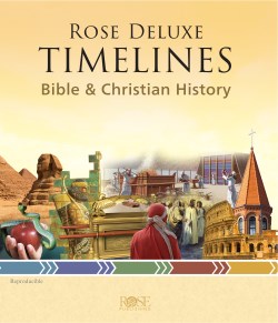
Rose Deluxe Timelines
$34.99Add to cartThis fully reproducible Rose Deluxe Timelines is packed with over 2,600 key Bible events in Bible and Christian history and features illustrations, summaries, and more! Enjoy these amazing features:
*Side by side 32″ timeline foldouts
*Illustrated and color coded
*Fully reproducible
*And more!Imagine having dozens of timelines on any Bible or church topic you could want-from Abraham and Isaac to the invention of the Gutenberg Press and Martin Luther King Jr.-all packed into one amazing book! See thousands of key events, people, and places at a glance in Rose’s new Deluxe Timelines book!
Enjoy Dozens of Full-Color, Illustrated Timelines at Your Fingertips!
Rose Deluxe Timelines is the ultimate resource for Bible and Christian history. With thousands of key dates, people, and events, each timeline is uniquely designed and features hundreds of photos and illustrations to enhance learning. These 28 timelines range from quick overviews offering the big picture of Bible and church history to large, detailed timelines that fold out up to 32 inches! Here’s a peek at what’s inside!
20+ Bible Timelines
*Book of Genesis: 120+ key events & people
*Bible Characters: Individual timelines for 8 major Bible figures
*Life of Jesus: Life & ministry of Christ in the Gospels
*Jerusalem: 140+ events from King David to today
*And more!7 Christian History Timelines
*The Early Church: Persecution, growth, heresies, martyrs, early theologians
*Reformation: John Wycliffe & Martin Luther to the Pilgrims & King James Bible
*How We Got the Bible: How Scripture was copied, translated & passed down
*Faith in America: 150+ events from the Colonial Period through the Civil War
*And more!Key Features of Rose Deluxe Timelines: Bible & Christian History
*Illustrated and full color: These visually attractive timelines provide extra depth and reference to your Bible study experience with illustrations and photographs. Don’t just read about people, places, and events-see them!
*Easy-to-read: With bold headers, color-coding, and easy-to-see text, it’s never been easier to absorb key information at a glance.
*Reproducible: Make up to 300 copies for your students or congregation
*All-in-one: This timeline resource is jam packed with timelines covering all the need-to-know subjects of the Old and New Testaments, Christian history, the Epistles, Bible history, and so much more!
Covers Every Major Time Period and Thousands of Key People & Event
-
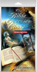
Bible Overview Chart
$13.95Add to cartA Comprehensive Graphic Outline in a new PORTABLE MAP STYLE format which allows it
to fit within most Bibles. It outlines the Old and New Testaments of the Bible and is organized chronologically, listing the chapter, book’s author, and significant events. There’s even color coded maps illustrating the location the writings took place making it easier to draw comparisons and analogies between Bible events vs. world events. This chart is a great supplement to any Bible study or can be used as a stand-alone religious timeline. -
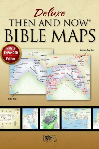
Deluxe Then And Now Bible Maps (Expanded)
$24.99Add to cartThis is the paperback version of the best-selling Deluxe Then and Now Bible Maps! This book lets you see where Bible places are today. Full-color Bible maps are alongside locations of modern-day cities and countries.
Connect the Middle East of the news with the Holy Land in Scripture. Includes maps for favorite Bible stories, like Abraham’s journey to the promised land, the exodus out of Egypt, the story of Ruth, David’s rise from shepherd to king, and Paul’s missionary journeys.
32 maps, including:
*Journeys of Abraham, Jacob, Joseph
*The Exodus
*The 12 Tribes of Israel
*Kingdoms of Saul, David, Solomon
*Holy Land in the Time of Jesus
*Journeys of Paul, Peter, Philip
*Early ChristianityCharts, timelines, and illustrations, including:
*Old and New Testament Timelines
*Tabernacle and Temple
*Exodus Timeline
*Ark of the Covenant
*Where Jesus Walked
*The 12 Disciples
*City of Jerusalem
*Jesus’ Journey to the Cross
*Seven Churches of RevelationAn excellent way to make your Sunday school, homeschool, and Bible studies more interesting. This book uses larger, easier-to-read type than most Bible atlases.
-
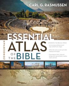
Zondervan Essential Atlas Of The Bible
$19.99Add to cartAn Up-Close and Comprehensive Look at the Lands of the Bible
No Bible Degree Required
Discover everything you need to know about the lands where Jesus walked, Moses traveled, and Paul preached. Packed with multidimensional maps, photos, and charts, the Zondervan Essential Atlas of the Bible is designed to help you better understand the history and places of the Bible and its world. This full-color atlas is concise but thorough, perfect for Bible students, travelers to the Holy Land, or any reader of the Bible curious to find out more about commonly mentioned places in the Old and New Testaments.
The Zondervan Essential Atlas of the Bible features:
*Nearly 200 stunning multidimensional and three-dimensional maps and full-color images
*Accurate and up-to-date mapping technologies
*Innovative chronological charts and maps covering historical backgrounds, regions, weather, and roadsWith this easy-to-understand atlas, you’ll find Bible study more engaging and comprehensible, and you’ll learn the essential facts about the fascinating lands of the Bible.
-

Rose Then And Now Bible Map Atlas
$49.99Add to cartRose Atlas of Then and Now Bible Maps with Biblical Backgrounds and Culture
by Paul H. Wright, president of Jerusalem University College (Institute of Holy Land Studies)The Best “Then and Now” Bible Atlas Ever – It has Features No Other Has!
*120 stunning detailed Bible maps
*Clear plastic overlays of modern cities and countries so you know where Bible places are today.
*Incredible insights into the lives of 30 important Bible characters. This atlas focuses on people – not regions — and how the geography affected their lives and decisions.For example:
*Know how David’s clever understanding of geography and politics led to his marriage with Ahinoam of Jezreel.
*Discover why Naomi, in the Book of Ruth, couldn’t just move back to Bethlehem after her husband’s death and use his land again.
*Find out why Moses and the Children of Israel took the long southern trek from Egypt to the
Promised Land, rather than the direct route.
This atlas gives you incredible insights into your favorite Bible stories. See the Table of Contents at the bottom. -
Chronological And Background Charts Of The New Testament
$19.99Add to cartThis helpful volume helps the student of the New Testament organize and synthesize the vast amount of biblical and extrabiblical material involved by providing a helpful visual overview of the data, chronology, historical background, and criticism of the New Testament. This format allows facts, relationships, parallels, and contrasts to be grasped quickly and easily.
-
Oxford Bible Atlas
$26.99Add to cartThis new edition of the Oxford Bible Atlas, now with full-colour maps and illustrations, has been thoroughly revised to bring it up to date with regard both to biblical scholarship and to archaeology and topography. The Atlas will help readers of the Bible understand the contexts in which its stories are set and to appreciate the world from which it emerged and which formed its background. Maps show the geographical setting of the Bible’s stories and reflect the successive stages of the Bible’s accounts, while specially chosen full-colour illustrations bring the countries and their peoples to life. The accompanying text describes the land of Palestine, and its wider ancient Near Eastern and east Mediterranean settings. It outlines clearly the successive historical periods, and describes the major civilizations with which Israelites, Jews, and early Christians came into contact. There is also an illustrated survey of the relevance of archaeology for the study of the Bible. The Atlas provides a superb guide to the geography of the Holy Land throughout biblical history, from the Exodus period through to New Testament times.
-
Then And Now Bible Maps Insert
$16.99Add to cartRose Bible Map Insert–An ultra-thin Bible atlas that fits in the back of your Bible.
This incredible full color Bible atlas has clear plastic overlays of modern-day cities and countries. Now you can have “Then and Now” Bible maps inside your Bible. Includes 44 pages; 8 plastic overlays; all maps in full color; larger print than other Bible map inserts; every major city in the Bible; a Bible time line; index; separate maps for each of Paul’s Journeys. -
Then And Now Bible Maps Pamphlet
$4.99Add to cartWhere are Bible Lands today? This handy quick reference fold-out shows you! It contains more than a dozen Bible maps that include the modern-day boundaries in red. Fantastic for comparing places in the news with places in the Bible.
Includes the following maps:
*The Middle East during Old Testament Times
*The Assyrian Empire, Babylonian Kingdoms and Persian Empire
*The Holy Land during the time of the Old Testament
*United Kingdom, Divided Kingdom compared with modern-day Israel and surrounding countries
*The Holy Land during the time of JesusAll of Paul’s Journeys (Roman Empire at AD 60)
Fits in the back of most Bibles. Size: 8.5″ x 5.5″ Unfolds 38 inches.
-
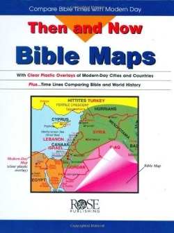
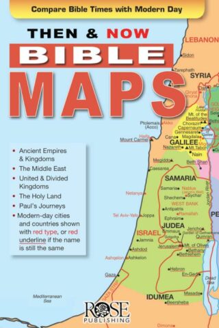
Then And Now Bible Maps
$19.99Add to cartTrying to connect the “Middle East” of the six o’clock news with the Holy Land of the Bible? Here’s a resource that fills in the blanks! Transparent maps of modern-day Mediterranean and Middle Eastern countries lie flat over Bible maps showing the lands and cities where the patriarchs, Jesus, and the apostle Paul traveled. Tremendously helpful!